The Goulbourn Wetland Complex
The Goulbourn Wetland Complex, found within the Mississippi River and Rideau River watersheds, covers 906 hectares (or approximately 2239 acres). See Figure 1.
The portion of the Goulbourn Wetland Complex of particular interest to the Friends of Stittsville Wetlands is located immediately west of the urban boundary of Stittsville and north and south of the TransCanada Trail.
The Goulbourn Wetland Complex
Figure 1.
The Goulbourn Wetland Complex is found within the watershed boundaries of the Mississippi River Conservation Authority and the Rideau River Conservation Authority. These boundaries reflect the geospatial data provided through Land Information Ontario (LIO).
The portion of the Goulbourn Wetland Complex of particular interest to the Friends of Stittsville Wetlands is located immediately west of the urban boundary of Stittsville and north and south of the Trans Canada Trail. This area is shown within the yellow oval. Please note that this is for illustration purposes and is not exact.
There are four types of wetlands in Ontario, including:
swamps, which are dominated by trees or shrubs
marshes, which usually have open areas of water with floating plants, like waterlilies and emergent plants (standing above the water) like cattails
bogs, which are peat-covered areas low in nutrient and strongly acidic
fens, which are also often found on peat but are less acidic and richer in nutrients than bogs
Source: Ontario Ministry of Natural Resources and Forestry. 2017. A Wetland Conservation Strategy for Ontario 2017–2030.
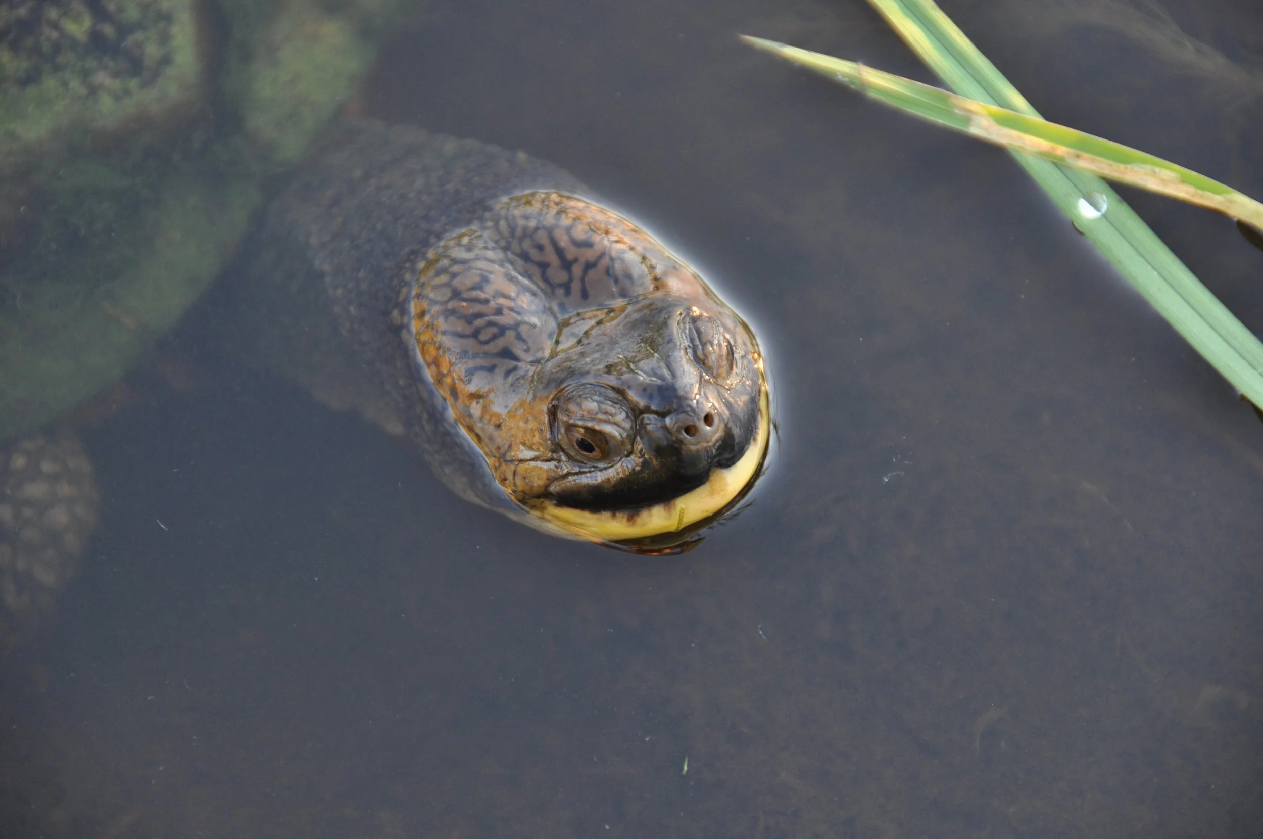
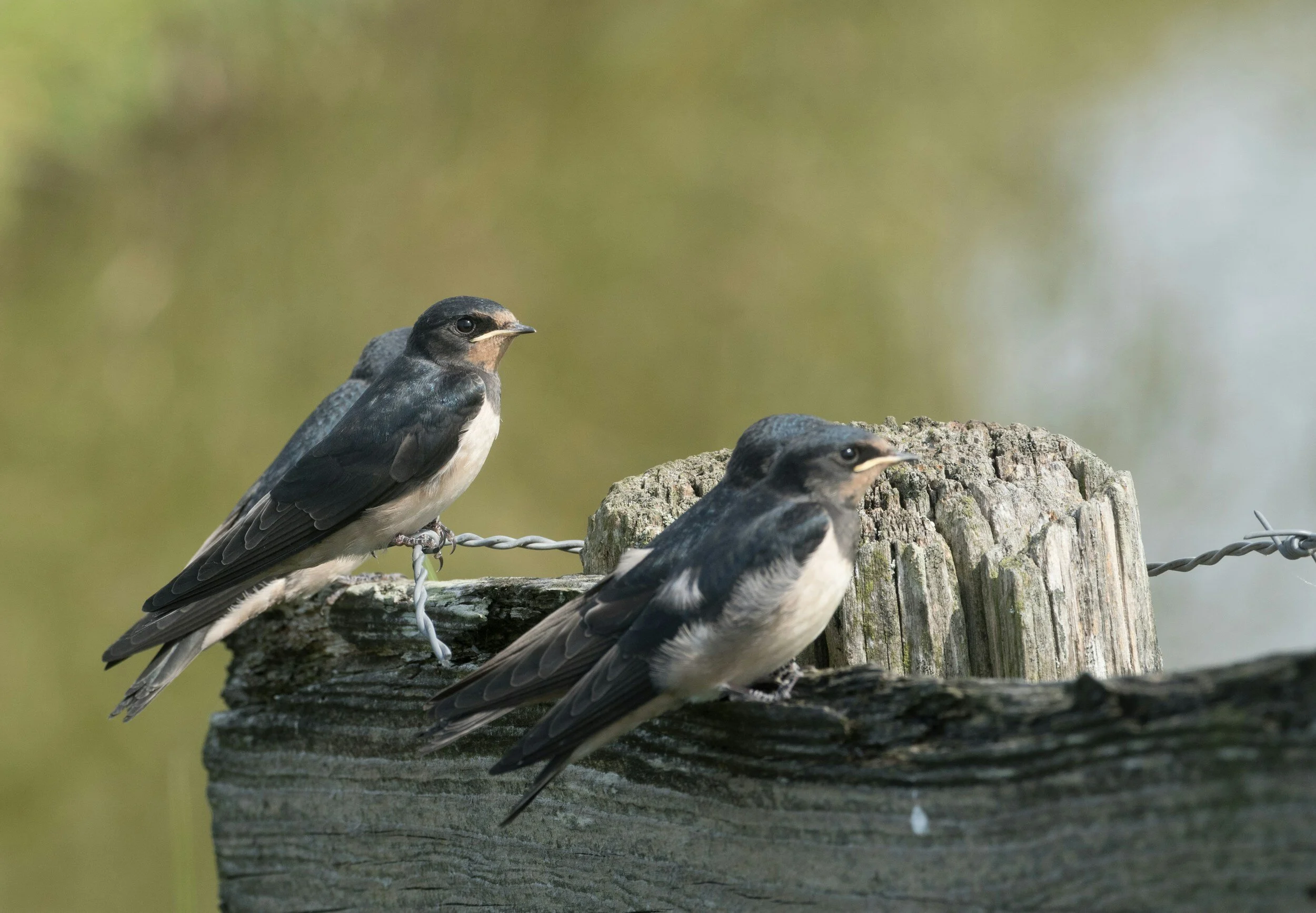
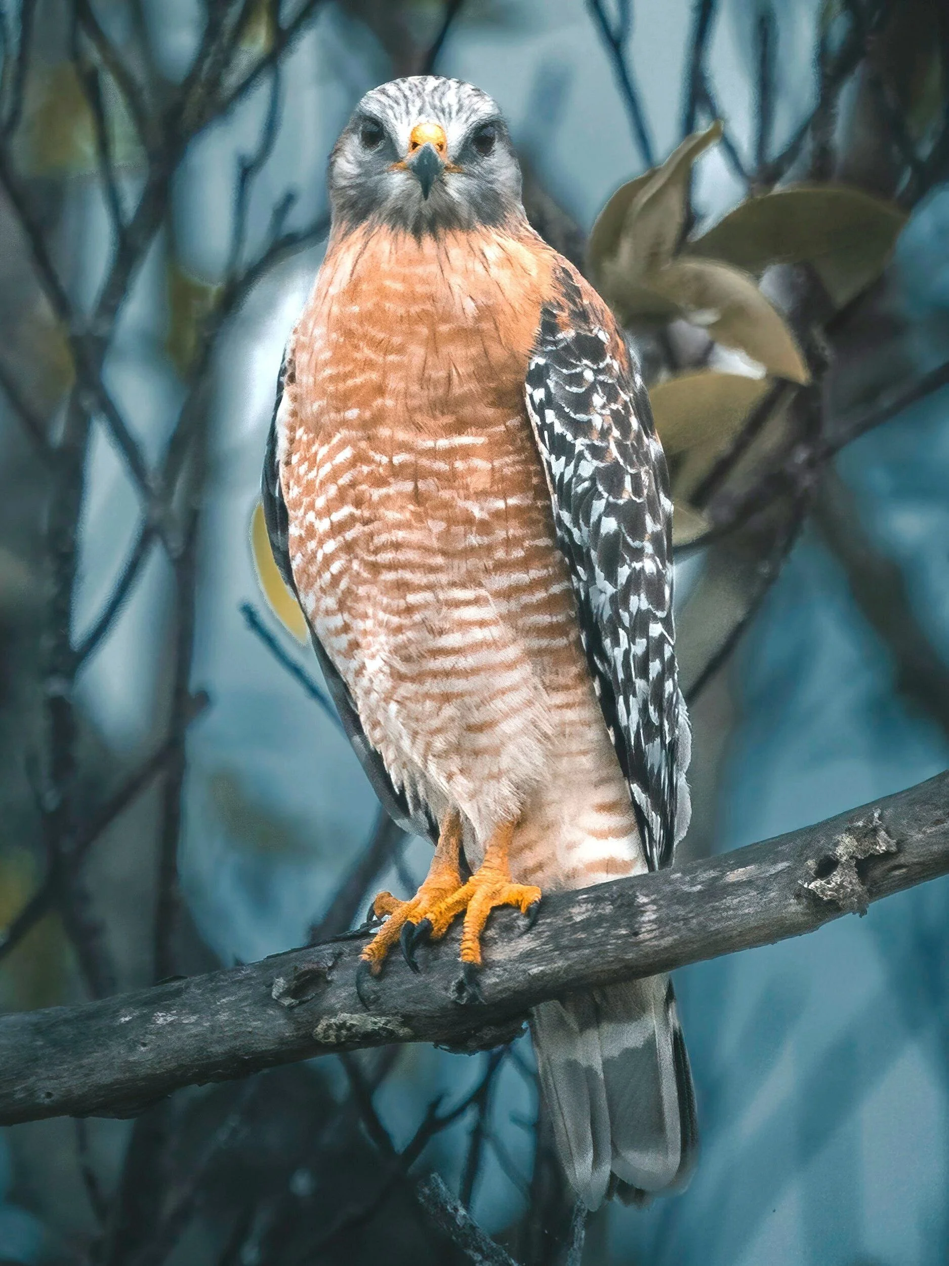
The Goulbourn Wetland Complex is composed of three types of wetlands – swamps, marshes, and fens. It provides a home to Species at Risk including Blanding Turtles, Snapping Turtles, and over 150 species of birds (eBird), including the Barn Swallow and three other Species at Risk. The Goulbourn Wetland Complex also provides habitat for the red shoulder hawk, a provincially significant animal species, Ram’s Head Lady’s Slipper, a provincially significant plant species as well as several other regionally and locally significant species.
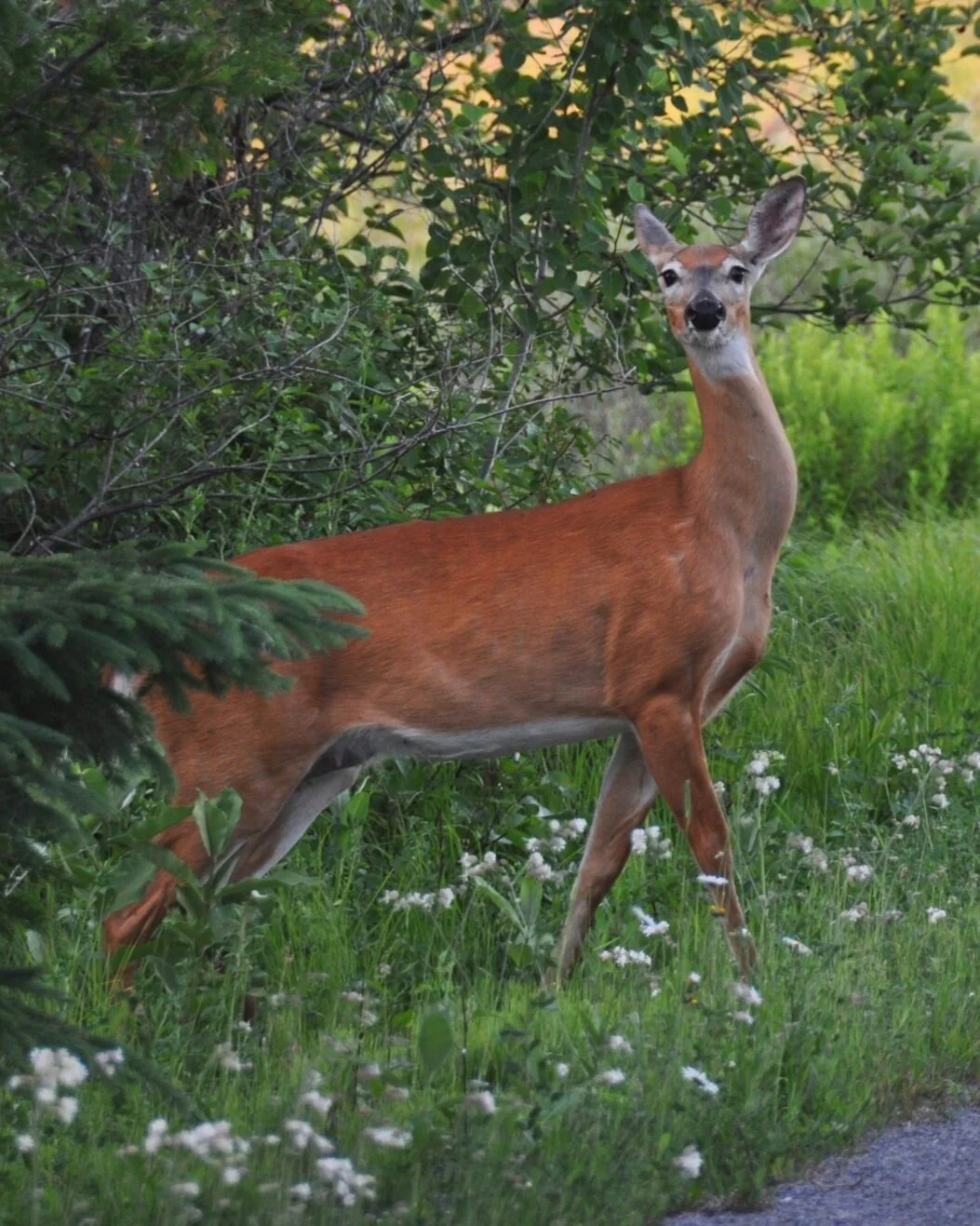
This wetland also serves as a habitat for various species, including Northern Spring Peeper, bullfrog, muskrat, raccoon, beaver, mink, red fox, coyote, white-tailed deer, and red squirrel.
Blandings Turtle
Photo by Sylvie Sabourin
Snapping Turtle
Photo by Donna Yarbrough
Ram’s Head Lady’s Slipper
Barn Swallow
Photo by Lia Maaskant
Red Shoulder Hawk
Photo by Greg Sellentin
White Tailed Deer
Photo by Slyvie Sabourin
Northern Spring Peeper
Photo by Ashlee Marie
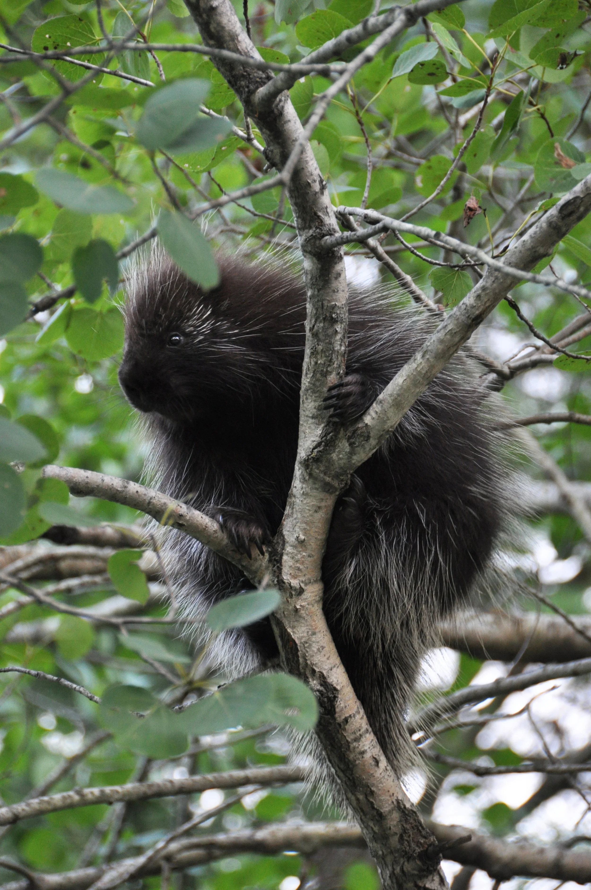
Porcupine
Photo by Sylvie Sabourin
Beaver
Photo by Niklas Hamann
Red Squirrel
Photo by Tyler Ambeau
The headwaters of Poole Creek, which runs through the heart of Stittsville, are found within that portion of the Goulbourn Wetland Complex within the Mississippi River watershed. Whereas the headwaters of Flowing Creek are found within that portion of the Goulbourn Wetland Complex within the Rideau River watershed. The ecological health and diverse functionality of both Poole Creek and Flowing Creek are dependent on the overall health of its headwaters, found within the Goulbourn Wetland Complex.
Poole Creek is part of the Carp River watershed which falls under the jurisdiction of the Mississippi Valley Conservation Authority. It is one of eight major tributaries of the Carp River. The Goulbourn Wetland Complex serves as a critical source of water for this watercourse and plays a significant role in maintaining its flow, particularly during dry/baseflow periods. [1]
The upper portion of Poole Creek, west of Stittsville Main Street, is considered a cold or cool water stream. That portion east of Stittsville Main Street is considered a warm habitat. [2] The cold or cool waters of Poole Creek are considered a crucial and rare habitat, sustaining a unique ecological system of significant environmental and recreational value to the community of Stittsville and Ottawa.
The Flowing Creek Catchment is approximately 50 square kilometers and occupies nine percent of the Jock River Subwatershed. This catchment area includes the Goulbourn Wetland Complex. The Mississippi-Rideau Source Protection initiative has mapped the middle of this catchment as a significant groundwater recharge area; and the western extent of the catchment as a Highly Vulnerable Aquifer. Parts of Wellhead Protection Areas (WHPA) C and D for the municipal wells in Richmond underlie the southern quarter of this catchment. The most recent Flowing Creek Catchment report was published by the RVCA in 2016. [3]
[1] https://mvc.on.ca/wp-content/uploads/2020/08/Final-Poole-Creek_V-Dec-2-2019.pdf
[2] https://app06.ottawa.ca/calendar/ottawa/archives/rmoc/Regional_Council/14Jun00/report_2.pdf
To learn more about the Goulbourn Wetland Complex check out Wild Stittsville: A Guide to Our Ecosystems and How We Can Re-wild Our Community written by Jessica Lozanski, a Canadian Conservation Corps alumni. The Canadian Conservation Corps is a branch of the Canadian Wildlife Federation. Jessica’s home community is Stittsville.
You can also learn more about other observed wildlife and plants through iNaturalist. iNaturalist is an online social network of people sharing biodiversity information to help each other learn about nature. Go to iNaturalist then click on “Explore” and under “Location” type Stittsville, Ottawa, ON, Canada and then choose “Map.”

Get Involved – Become a Friend!
We are growing and we need your help! Together, we will be the voice to protect, restore, regenerate, and rewild our wetlands.

